Satellite Town Ring Road: What It Means for Devanahalli

Featured Image of Satellite Town Ring Road: What It Means for Devanahalli


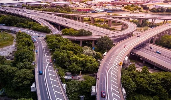
The Satellite Town Ring Road, numbered NH 648 and known across the city as the STRR, is the orbital highway that now defines Devanahalli's position in the Bengaluru region. It runs past the airport belt linking Hoskote in the east to Doddaballapur and Dobbaspet in the west, and it passes 2 km from Prestige Parklane, about two minutes by car.

What the STRR Is


The Satellite Town Ring Road is an outer orbital route designed to connect the satellite towns around Bengaluru rather than the city's own suburbs. Its purpose is to move freight and long-distance traffic around the metropolis instead of through it, which is why it matters to industrial belts more than to central neighbourhoods.

For Devanahalli, that role is doubly useful. The town already sits on NH-44 heading north, so the STRR adds an east-west axis to a corridor that previously had only one main direction of travel.

What the STRR Means for Devanahalli


An orbital road changes a location's reach without changing its address. From the Devanahalli side, the STRR opens routes to Hoskote and the eastern industrial belt in one direction, and to Doddaballapur and Dobbaspet in the other, without entering the city.

That matters for three groups in particular.

  • Industry: the KIADB aerospace park and the manufacturing plants nearby depend on freight movement that avoids city traffic.

  • Commuters: workers travelling between the northern and eastern belts gain a route that skips Hebbal and the Outer Ring Road.
  • Homebuyers: an address 2 km from an orbital highway keeps travel times steady even as the city grows.

Where the STRR Sits Relative to Prestige Parklane


From Prestige Parklane to Distance Drive time
Satellite Town Ring Road (NH 648) 2 km 2 minutes
Devanahalli town 8.7 km 13 minutes
Kempegowda International Airport 20 km 25 to 30 minutes
Yelahanka 29.4 km 25 minutes
Bengaluru city centre (Majestic) 45 km 1 hour 25 minutes

The STRR and the Wider Road Network


The STRR does not work alone, and its value comes from what it connects to. NH-44, the Bellary Road, carries traffic north to the airport and south towards Hebbal and the city, while IVC Road serves local movement across the Devanahalli belt.

A Peripheral Ring Road is also planned for the region, which would add a further orbital closer to the city. Together these roads explain why the northern corridor has absorbed so much industrial and residential investment over the past decade.

Roads Already Built Around the Project


Infrastructure promises are common in property marketing, so it is worth separating what exists from what is planned. The STRR is in use today, and KIADB has completed the approach and arterial roads to Plot No. 24, with a concrete carriageway, street lighting and a planted median.

The metro is the part still under construction. Doddajala station sits on the Namma Metro Blue Line Phase 2B, a 58.19 km route with 29 stations, and its airport section is targeted for March 2028.

How the STRR Links Devanahalli and Hoskote


Hoskote lies at the eastern end of the ring road, and it is the industrial and logistics counterpart to Devanahalli's aerospace belt. The STRR connects the two directly, and BMTC route 298-P runs between them, stopping 1.6 km from Prestige Parklane at Channahalli and 2.3 km away at Haraluru Gate.

For buyers comparing the two corridors, the road is the reason they are often mentioned together despite sitting on opposite sides of the city.

Living Beside the Ring Road


An orbital highway is worth most to the people who live a couple of minutes from it, and Prestige Parklane sits 2 km from the STRR inside KIADB Aerospace Park Phase 2. That puts Hoskote and the eastern belt in one direction and Doddaballapur in the other, without touching city traffic.

The road is already carrying traffic today, which is the part of the corridor's infrastructure that needs no waiting.

FAQs


1. What is the Satellite Town Ring Road?

It is an orbital highway, numbered NH 648, that connects the satellite towns around Bengaluru so that freight and long-distance traffic can bypass the city.

2. How far is the STRR from Prestige Parklane?

The ring road passes 2 km from the project, which is about two minutes by car from the KIADB Aerospace Park Phase 2 entrance.

3. Which towns does the STRR connect near Devanahalli?

From this stretch it runs east towards Hoskote and west towards Doddaballapur and Dobbaspet, crossing NH-44 near the airport belt.

4. Why does the STRR matter for Devanahalli property?

It gives the corridor an east-west route that avoids city traffic, which supports both industrial freight and daily travel between the northern and eastern belts.

5. Is the STRR already open near Devanahalli?

Yes, this stretch is in use, and the KIADB approach roads to the project are complete with carriageway, lighting and a planted median.

6. Will the metro serve this corridor as well?

Doddajala station on the Namma Metro Blue Line is under construction, with the airport section of the 58.19 km line targeted for March 2028.

Prestige Parklane Blog


Enquiry
Enquire Now